
It’s hard to believe that the first printing of our Pittsburgh Bike Map was in 2007
Barack Obama had yet to be elected president, and City had just installed the Liberty Ave bike lanes – the first ones painted since the early 80s.
In those eleven years, we’ve distributed hundreds of thousands of copies, and made, literally, thousands of edits including the constant revisions and errors that we’ve made along the way. Some errors, were straight up embarrassing, like how we once misspelled “cemetery,” “Belmar,” and even the word “bicycle.” Others fixes over the years included tweaks to the bike routes, elimination of paper streets, and legibility.
But we especially take pride in certain edits. We’ve always considered the map an effective advocacy tool in addition to the route planning utility. Since the map shows where the bike infrastructure exists, it also highlights where it’s missing. Additionally, we attempt to represent stress levels by color coding, in red, the “cautionary bike routes,” ie roads on the bike network that tend to be more stressful yet hard to avoid. In a way, the map can be interpreted as a de facto bike plan for the city, since the actual bike plan hasn’t been updated since 1999.
Every time we add a bike lane or protected bike lane, or turn a street from red to blue, it becomes a moment of celebration. In fact, on the first addition of the Pittsburgh Bike Map, we didn’t even bother to put “bike lane” in the legend, because there were so few at the time to even bother.
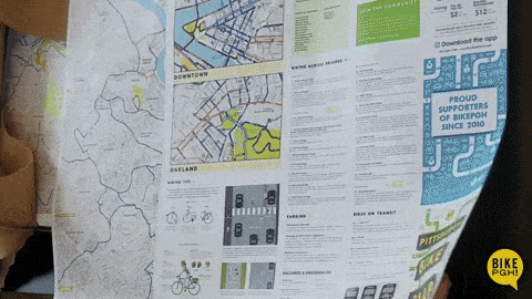
Check out the new map fold!
What are the Big changes for version 7?
We are also happy to announce that we have made some significant changes to our map, so it’s much more than an update. Most obviously, we were able to put most of the city onto one side of the map.
One of the biggest complaints we’ve had since the beginning, was that you had to flip the map over to connect the streets, making route planning more difficult. With a bit of creative design, we’ve incorporated a “fold-in” to the map, that seamlessly connects the western neighborhoods to the rest of the city.
Healthy Ride Bike Share Expansion
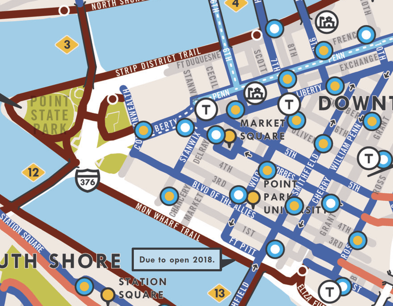
Another exciting update is that we incorporated Healthy Ride’s 2018 bike share expansion. In the previous version, we added Healthy Ride stations, as they’ve become an integral piece of Pittsburgh’s bike infrastructure. This year, however, Healthy Ride announced that they are expanding from 50 to 175 stations, and adding an additional 200 bikes over the course of the summer. We’ve shown the expansion stations in a different color, so please understand that these may or may not be online until the end if the year. About 20 new stations per month will be installed, so be sure to check Healthy Ride’s website for the most up-to-date information.
Bikeable sidewalks and more bonus features
Making the Connection
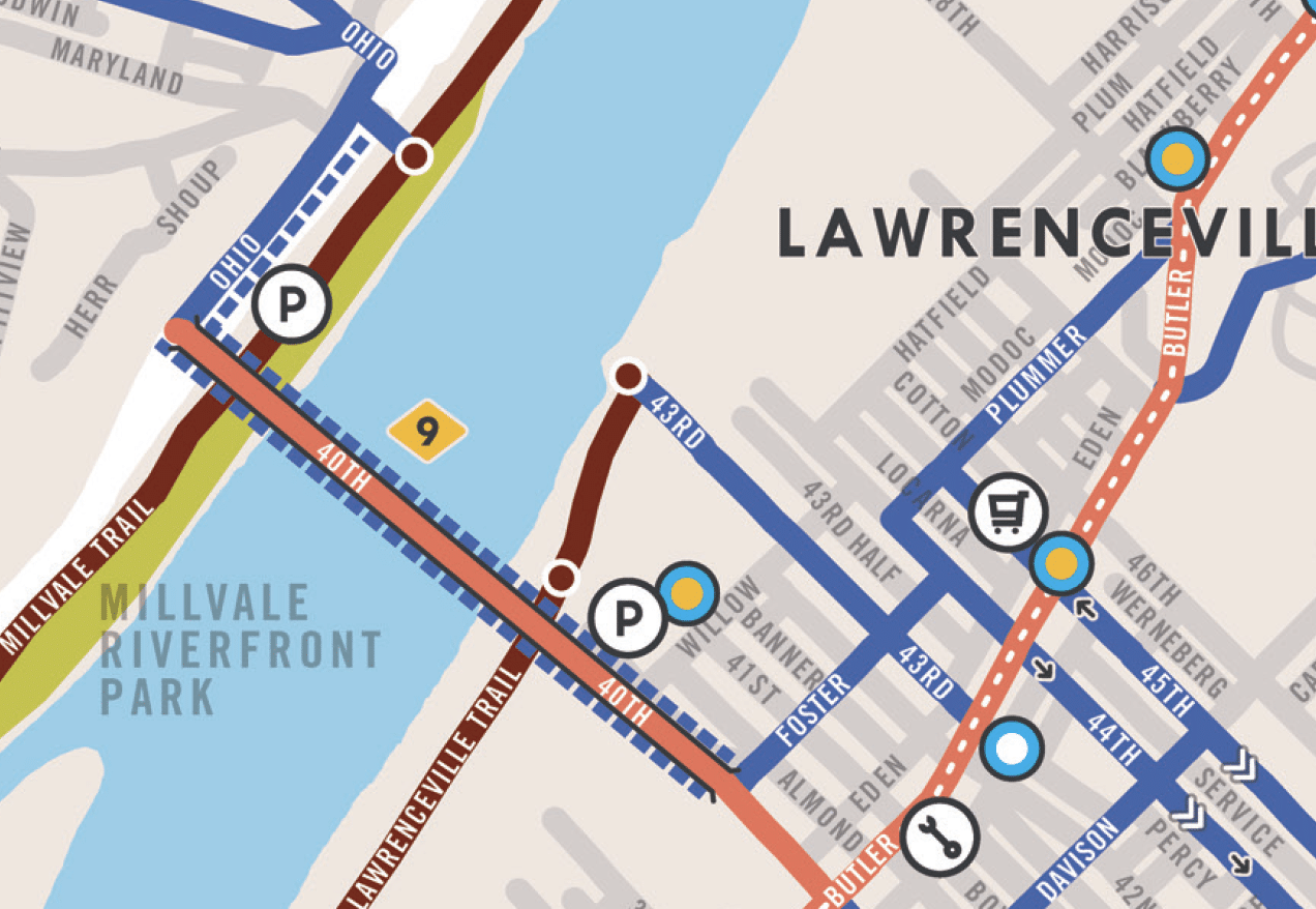
Additionally, there are several useful bike/ped connections around the city, that may not be so obvious. For instance, there’s a bike ped bridge over some highways that connect you from the Heinz St to Troy Hill Rd, making for a nice connection from the Northside Trail. These kinds of details are difficult for online mapping resources to demonstrate, and we hope that a good, old fashioned paper map will help make these transitions easier, safer and more intuitive for map users.
Finally, in addition to the detail of Downtown, this year we’ve added an inset for Oakland as well, the university district and cultural center of Pittsburgh.
We’d like to give a special shout out to Highmark for supporting Version 7 of the Pittsburgh Bike Map. Their continued support of Bike Pittsburgh, and cycling in general, is much appreciated.
BikePGH MAP RELEASE PARTY
Celebrate the 7th Edition of the Pittsburgh Bike Map! Be the FIRST to check out the new map and see what we updated from the last edition.
Date: Thursday, May 31
Time: 6-8pm
Location: East End Brewing Company
Address: 147 Julius St, Pittsburgh, Pennsylvania 15206

Sign up for Bike Pittsburgh’s newsletter, The Messenger, to get the latest news on events, bike and pedestrian infrastructure, and fun, delivered straight to your inbox. Twice monthly emails, no spam.