2010-10-12 15:51:43
78
Street view scavenger hunt (find the bikes)
Every once and a while I will be looking at something on street view and I'll run across someone riding a bike. When you find a Pittsburgh cyclist on street view, post a link of it here! Sometimes they blur out the face, but I'm guessing a lot of people here can probably ID their friends from only their bike.
To post a link here, get the street view you want up on your browser, click the "link" icon/text on the upper right hand corner of your google map window. You want the first link in that popup.. the one that says "Paste link in email or IM". Paste it here replacing link.com with the thing google gave you:

Yesterday, Colin mentioned this scofflaw cyclist caught cutting through Sandcastle: side and front
2010-10-12 15:13:04
Dang, you were fast on that shot. That was the exact view I was going to post!
2010-10-12 16:23:46
Ha, my ladyfriend participated in that Sampsonia Way thing. Goofy art kidz
2010-10-13 22:11:58
2010-10-18 00:49:57
My parents are on streetview! Riding in clairton.
2010-10-18 12:13:17
5300 block of Penn Avenue (near Aiken). Guy riding inbound on Penn.
2010-10-18 13:23:13
Dude biking up 1 Wild Place - you can follow him all the way up the hill.
2010-12-11 22:08:43
Top! Swalfoort mentioned seeing a cyclist in a StreetView image I posted a few hours ago, which made me think of this thread.
Yep, there's someone on a bike, moving away from the camera, off in the distance. [SV link, Saline by Greenfield/Irvine/Second]
I didn't navigate around to try to get a better view.
Did anyone else notice that the camera had to be on the sidewalk at this point? Was this done with Google's trail camera?
2011-10-15 04:27:42
Yea, definitely on the sidewalk. Here is a better view.
2011-10-15 04:38:32
grant and 6th, downtown
http://g.co/maps/4567y
2011-10-15 04:56:33
Wow! It looks like those last two might have documented the existence of the less common female rider in Pittsburgh.
2011-10-15 12:14:47
2011-10-15 12:18:12
214 West General Robinson (PNC Park) when viewed coming from west. Guy on a bike crossing the street just west of the crosswalk.
2011-10-16 16:30:38
Three Rivers Heritage Trail between PNC Park and DelMonte (at base of stairs/planting.) Another woman rider.
Three riders (two off their bikes) at water feature near Heinz Field on Three Rivers Heritage Trail.
2011-10-16 16:33:10
At funky stature on "upper" trail near Carnegie Science Center. then jump to lower trail, and look west, and you'll see another cyclist riding westbound
2011-10-16 16:37:53
you can follow this guy all the way up Murray ave. I wish he'd take the lane!
2011-10-17 19:22:59
@Marko; been googling tags? When I click on that link, above, the sidebar to the left is filled with information that I THINK pertains to a recent and/or current tag.
My personal suspicion....the clue lies in the use of moo-ving.
2011-10-17 20:16:19
Ha ha, busted. I was checking out the icecream shop in the area. I was also looking for a certain pop distributer - all dead ends so far.
2011-10-17 20:23:17
Glad to know I have you guys and girls stumped. ")
2011-10-17 21:28:14
2011-10-18 17:51:23
14th and Smallman - cyclist carrying a big drink cooler
2011-10-18 17:55:07
Strip District, near the Produce T
2011-10-18 17:57:02
The last entry doesn't come up in StreetView if just clicked on. (just gives you the map) But edit the URL to remove a stray "erminal" off the end and StreetView appears, showing the cyclist.
2011-10-18 19:31:57
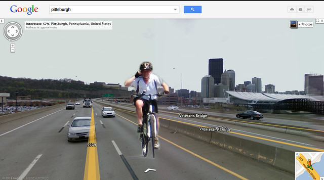
Holy Crap - me on the Veterans Bridge! In the fast lane.
2011-10-18 23:41:33
Dan, are you on your cell while on the bridge? Seems unsafe...
")
2011-10-18 23:46:21
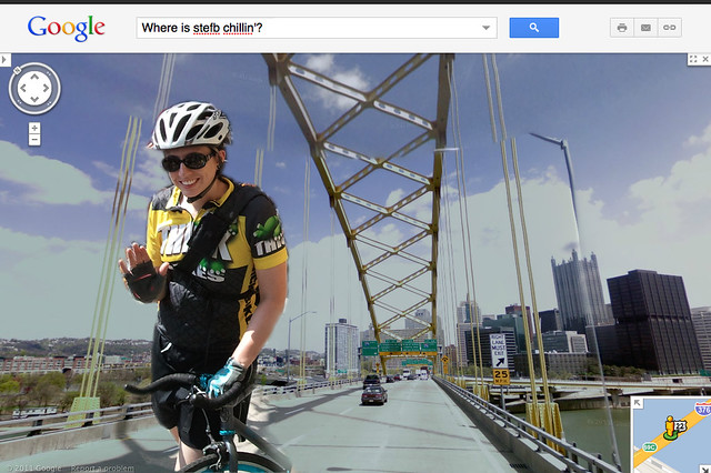
stefb on the Ft Pitt Bridge
@reddan - calling 911 in advance
2011-10-18 23:58:11
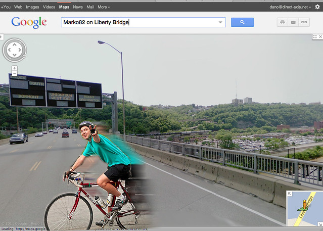
Marko82 flyin' home on the Liberty Bridge.
2011-10-19 00:32:13
Not only is stefb on the FT Pitt Bridge she's going the wrong way
2011-10-19 00:34:34
Here's the guy on Penn at Aiken.....
2011-10-19 21:34:02
Guy at PNC Park crossing East General Robinson
2011-10-19 21:35:29
Female rider near PNC Park, on trail
Three cyclists at water feature near PNC Park on trail.
North Shore Trail under Ft. Duquesne Bridge
2011-10-19 21:42:40
Hahah tdw, I got your PM. I hadn't opened this thread for whatever reason until now. Nice! You caught me taking a dump on all of the bad drivers not using turn signals on the bridge!
Also those fingerless gloves only lasted about 2500 miles. They matched my road bike in perticular so well. We had a good summer, gloves!
2011-10-21 08:56:52
found this as i was preparing a blog post about the sharrows and future bike lanes on brighton. A Double!!!
2011-12-01 16:01:16
here's a brave soul on W Carson St that i found while making a blog post about w carson st public meeting
2011-12-05 21:58:45
Looks like his bike's a tad small for him.
2011-12-07 00:15:31
Bike cop downtown:
View Larger Map
2013-01-30 12:34:32
Here's me on the Hot Metal bridge ramp:
http://goo.gl/maps/8ELtC
They reshot the trail, apparently, and there are other cyclists you can see around there, too.
2013-01-30 12:48:58
Hm, this thread isn't as stale as I thought, only 4 months.
Just found another example: West Station Square Drive below the Duquesne Incline. Does anyone recognize this rider?
Street View
2013-05-30 21:50:42
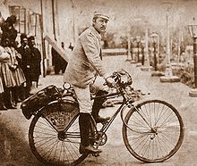
Whoa, I think it's Frank Lenz.
2013-05-31 05:29:31
Google still shows the exit from the Jail Trail to Bates. I miss it.
Exit to Bates
2013-05-31 11:39:25
In scoping out vantage points for the downtown cordon (bike) count on Wednesday, I found therse:
https://maps.google.com/maps?q=Pittsburgh,+PA&hl=en&ll=40.443792,-80.002642&spn=0.002658,0.00611&sll=41.117935,-77.604698&sspn=5.387045,12.513428&hnear=Pittsburgh,+Allegheny,+Pennsylvania&t=m&z=18&layer=c&cbll=40.443792,-80.002642&panoid=3fHKpwqzZ0NCKYyoePsT7w&cbp=12,114.17,,0,0
https://maps.google.com/maps?q=Pittsburgh,+PA&hl=en&ll=40.444804,-79.994151&spn=0.001337,0.003055&sll=41.117935,-77.604698&sspn=5.387045,12.513428&hnear=Pittsburgh,+Allegheny,+Pennsylvania&t=m&z=19&layer=c&cbll=40.444838,-79.994017&panoid=au4mQrrQFo2YoW2jl7cXVg&cbp=12,217.71,,0,5.41
First one is of a bike cop on Seventh Avenue in front of the Byham, the second is a sidewalk rider on Penn Avenue approahing 11th.
2013-06-03 14:43:21
an east carson street double!
http://goo.gl/maps/a4AA7
2013-07-25 10:38:07
Ugh, I can't seem to get the Street View to pop up nicely for this cyclist, but he's riding along the TRHT between the Casino and then under the WE Bridge. You can see how excited he is to see the Google Mapping vehicle (I'm guessing it's a guy on a bike with a specially adapted camera?). If you follow them along the trail, he takes pictures of the GMV with his cell phone and then follows the GMV and talks to the operator as they travel together. Kinda interesting.
http://goo.gl/Eu4gGh
2013-07-25 13:07:16
RustyRed wrote:Ugh, I can’t seem to get the Street View to pop up nicely for this cyclist, but he’s riding along the TRHT between the Casino and then under the WE Bridge.That is so cool! Best if you start east of the WE bridge. It funny how for part of the ride, the "bicyclist" is just a disembodied head and helmet, because of the way google merges pictures.
2013-07-25 17:46:03
In looking at that segment along the trail, there was one old picture which showed the blue plastic structure (an outdoor classroom) in the CSC parking lot.
It was removed at least 3 years ago.
2013-07-26 07:37:58
@ Helen S It was removed at least 3 years ago.
Since there's still plenty of trails (and roads) that aren't on Streetview at all yet, we can't expect that updating the views they have to be a high priority.
2013-07-26 13:31:16
i think it was swalfoort that originally found this one, but it's soooo good it needs to be reposted.
http://goo.gl/maps/GVyjR
2013-07-26 14:14:50
^^^^ hahaaa - not what I expected, but classic.
2013-07-28 07:51:36
@ erok - oddly enough, if you back out to the map and try to find those guys again, they aren't there.
2013-07-29 13:15:53
http://goo.gl/maps/iSCUh
dude looking for bike parking in the strip
2013-08-15 13:52:44
Here's one I found last night of someone climbing South 18th Street in front of Ultimate Auto (just above Saber Park in case my link doesn't work right). The rider is visible when viewed coming down the hill or on a side view, but disappears if you try to find him in the uphill view.
2013-08-15 16:31:04
2013-08-15 16:31:44
The uphill 'he's there' downhill 'he's not.' has to do with when they ran the car, at least sometimes. Sometimes the view in opposing directions shows wildly different weather, for example.
It is always fun to play around with these images...
front, back, approach from a side street, etc.
on the photo erok reposted, i was trying to get a look at the adjoining public steps.
2013-08-15 18:03:32
Such a pleasant unexpected surprise lol
2013-08-15 18:21:33
Me and my son in North Point Breeze a couple of months ago.
N Dallas and Kelly St
2014-11-13 15:04:02
@bhattenb: I might be missing something, but why is you son's face pixilated and yours is not? Do you fail the "human face" test?
2014-11-13 22:28:34
I do. Luckily my son has his mother's good looks.
2014-11-14 08:51:07
Found a new one! 40th Street Bridge, apparently re-taken in Aug 2014.
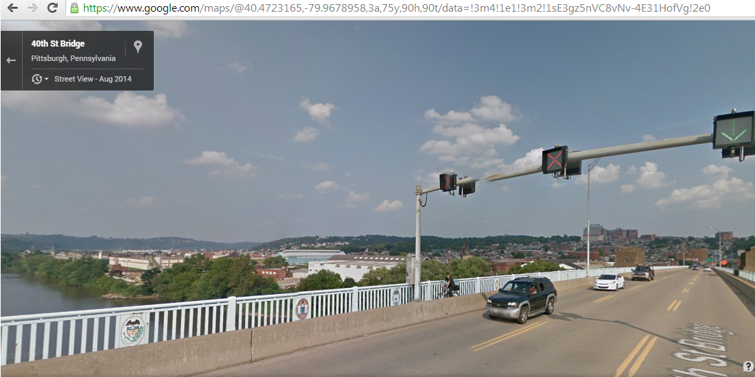
2014-12-14 16:52:55
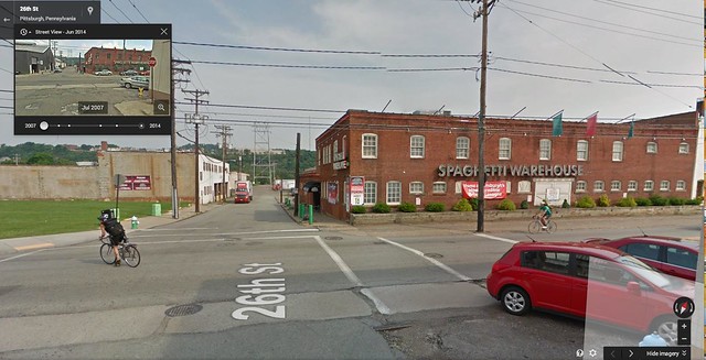
Found this one on Penn Avenue in the Strip today:
https://www.google.com/maps/@40.4602212,-79.9707622,3a,75y,257.3h,80.6t/data=!3m4!1e1!3m2!1scxW1V98yDoiwJxLO4mZt3g!2e0?hl=en
2014-12-19 16:25:36
2014-12-20 20:29:27
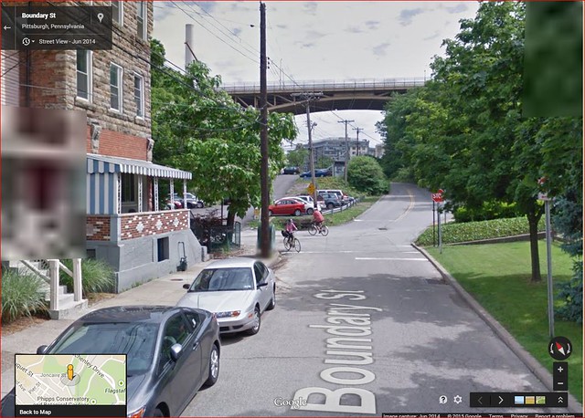
Joncaire Street, near base of stairs....woman in pink.
https://www.google.com/maps/@40.440426,-79.950249,3a,75y,237.85h,71.06t/data=!3m4!1e1!3m2!1sLZHihmOdDN8sL6wvlD8FMA!2e0?hl=en
2015-01-15 14:51:39
@swalfoort Joncaire Street, near base of stairs….woman in pink.
you can follow her all the way down from the very top of the hill
And if you take about two steps towards the Junction Hollow trail, there is a dude - in pink!
https://maps.google.com/maps?ll=40.440426,-79.950249&spn=0.18,0.3&cbll=40.440426,-79.950249&layer=c&panoid=LZHihmOdDN8sL6wvlD8FMA&cbp=,237.85,,0,18.940002&output=classic&dg=ntvb
One step farther and you can see them start to cross paths!
https://maps.google.com/maps?ll=40.440426,-79.950249&spn=0.18,0.3&cbll=40.440426,-79.950249&layer=c&panoid=LZHihmOdDN8sL6wvlD8FMA&cbp=,237.85,,0,18.940002&output=classic&dg=ntvb
And the woman in pink continues to fo0llow the Google van.
This is like a romance - as portrayed in Portlandia!
2015-01-15 15:15:30
@swalfoort and @Mick:
That's another 2-fer!
2015-01-15 15:38:02
This german shepard seems unfazed by the google car:
https://www.google.com/maps/@40.291942,-79.951201,3a,75y,350.16h,61.95t/data=!3m4!1e1!3m2!1sjSatb0-j6quSEJPRHwQlDA!2e0?hl=en
2015-01-20 09:35:21
16th at Spring Way
https://goo.gl/maps/zbPw39GTMZU2
2016-01-13 12:54:40
Nice- No hands turn into oncoming traffic (or just a lazy left cutting across?). Is that a beverage can in the right hand?
2016-01-13 14:10:06
@helen that is indeed a can in his right hand
While looking for myself on northbound Stanwix and Third Ave (a couple months ago I noticed that the Google Maps car was behind me), I found this guy turning left from southbound Stanwix into BOTA:
https://www.google.com/maps/@40.4398692,-80.0048514,3a,75y,206.52h,68.11t/data=!3m6!1e1!3m4!1sT_7vOMhIcC6S2Vi-0tni5A!2e0!7i13312!8i6656!6m1!1e1
2016-01-13 17:26:33
This Grown and Sexy cyclist:
https://www.google.com/maps/@40.4544765,-79.9790455,3a,68y,337.37h,70.03t/data=!3m6!1e1!3m4!1s6iO87tFI6d8dABRRsfu-bA!2e0!7i13312!8i6656!6m1!1e1
2016-01-13 20:10:12
Not surprising a cyclist was captured making the wiggle onto Spring Way at 16th St, as that's about the only logical place to go once getting to the end of the bike lane.
2016-01-14 10:41:58
Hahaha, I forgot about this game too. Back in October, I was at the intersection of Commonwealth Place and Liberty near the Point, intending to make a left onto the Blvd, when I saw the Google car coming the opposite direction and turning off onto Liberty. I made a mental note to check Street View later, but as all my mental notes tend to go...it just flew right out of my brain. :)
This reminded me to check again, so there I am, with my Raleigh:
https://goo.gl/maps/gWBMjdPczby
2016-01-15 17:44:25
Nice!
Here's a different head-on view of you:
https://www.google.com/maps/@40.4406598,-80.0067218,3a,15y,350.74h,84.54t/data=!3m6!1e1!3m4!1s4RCGQNx_oSTonPBnHrN4kg!2e0!7i13312!8i6656
2016-01-15 17:52:26
Nice shot of a milk crater going down Greenleaf (just off Saw Mill Run/Steuben).
2016-01-30 21:38:45
Not on a bike, but here's the City's Bike/Ped Coordinator on Smithfield St
2016-02-03 10:53:49
2016-02-18 21:31:14
Brand loyalty @ 6th & Lib
Am I overdoing this, or do people want moar?
2016-02-19 16:14:08
Pedicab at work in December!
https://www.google.com/maps/@40.443574,-79.9989862,3a,86.4y,69.16h,73.91t/data=!3m7!1e1!3m5!1sfY3696ewr2LWTe0nQdD96Q!2e0!5s20151201T000000!7i13312!8i6656!6m1!1e1
People we know!
https://www.google.com/maps/@40.4565382,-79.9701274,3a,41.5y,225.99h,81.62t/data=!3m6!1e1!3m4!1snSHfXHzAL7CthDyLVzdHQg!2e0!7i13312!8i6656
2016-04-14 08:38:05
Keep 'em coming, Ornoth! I love them. Who doesn't like photos of cyclists on City Streets? (Ok, who on this board?)
2016-04-14 09:31:01