Thanks to Chad's inspiration, I did the Pittsburgh to DC bike tour from 7/4 to 7/9. Below is my story:
7/4: Pittsburgh to Confluence - 99.34 miles

More pictures at:
https://www.facebook.com/media/set/?set=a.10154065074850865.1073741845.631440864&type=1&l=fe871e9b4e
I left my home at Highland Park at 7 am, took pictures at the Point State Park fountain (GAP 150) for a while, and began the journey at 8 am. I arrived at McKeesport (GAP 132) at 10 am. The trailhead on the River Drive was a bit vague, but I found it at the end. The trail surface turned from asphalt to crushed stones soon afterward. Despite so, I was making good progress and got to West Newton (GAP 114) at noon. I had lunch at the Fox’s Pizza Den next to the tourist information center. The heavy rain started coming down soon after I left West Newton at 1 pm. Thanks to the rain cape and gaiters I wore, I didn’t get soaking wet. I entered Ohiopyle (GAP 88) at 6 pm and had dinner the Falls Market Restaurant. I decided to push forward after dinner since I had made reservation for a tent site at Confluence (GAP 61). It was still raining when I arrived at the Outflow Campground at Confluence. I learned from the receptionist that there’s no need to reserve a tent site since there’s biker/hiker camping area which is never full, and is only $8 per night. Nevertheless, I was grateful that the tent site I reserved was closer to the shower facilities, so I didn’t have walk a longer distance to get to them. Due to the ongoing rain, the inside of my tent was a bit wet when I turned in for the night.
7/5: Confluence to Cumberland – 64.47 miles

More pictures at:
https://www.facebook.com/media/set/?set=a.10154065487625865.1073741846.631440864&type=1&l=62b349fe44
I had a terrible sleep due to my leaky tent, and woke up at 6:30 am. I packed up my wet camping gear and went into Confluence (GAP 61) to get breakfast at 8 am. I had a hearty breakfast at the Sister Café, which worked wonders in raising my morale. I ordered the “Sunrise Scramble”, which consisted of eggs, ham, peppers, onions, mushrooms, and potatoes, as well as gravy on top of them. I got on the road at 9 am, and reached Pinkerton Horn bridges and tunnel (GAP 52) at 10 am. I arrived at the Salisbury Viaduct (GAP 34) at 12:30 pm. The length of the viaduct and the panoramic view it provided made a lasting impression. I stopped at Meyersdale (GAP 32) for lunch. Unfortunately, the only trail-side restaurant – “Joe Greens Fresh Eatery” – was closed, so I had to go down the steep Main St and dined at the “GI Dayroom Coffee Shop” instead. Their food was just the usual American fare. Coming back on the trail was tough – the Main St climb was probably steeper than any sections of the GAP and C&O. The Meyersdale’s tourist information center is housed in the old train station like the one at West Newton, but it also serves as a museum with many exhibitions. Make sure to check out the model train room – it is very entertaining. I also met a bicycle tour group led by the Bubba’s Pampered Pedalers at Meyerdale. Bubba is a very nice guy, and his customers seemed to enjoy his tour a lot. I might join his tour if my parents want to do the GAP and C&O ride with me in the future. I reached the continental divide (GAP 24) and the Big Savage tunnel (GAP 23) around 3 pm. Riding through the Big Savage tunnel reminded me of the experience of going through the Liberty tunnel in Pittsburgh during the Dirty Dozen ride. The view just beyond the Big Savage tunnel was also breath-taking. The Mason-Dixon Line (GAP 21) was just another mile from the vista. Afterward, it was a long and steady downhill ride to Cumberland (GAP 0). I arrived at the Cumberland Visitor Center at 5:30 pm. After taking a few pictures, I went to YMCA to camp for the night. I grabbed dinner at Sheetz along the way. It is possible to camp at YMCA for free if you are not planning to use their facilities. But for $15, you’ll have full access to their shower facilities, as well as the pool and gym. Their campground is just across the street, and you could set up your tent under the pavilion if it is very rainy. I was joined by Dave, Steve and Brian around 9 pm, who also had similar travel plan as I did.
7/6: Cumberland to Hancock – 63.34 miles

More pictures at:
https://www.facebook.com/media/set/?set=a.10154069430030865.1073741847.631440864&type=1&l=c60c6bb2cb
I left the YMCA campground at 7:30 am with my travel partners, Brian and Dave, whom I met last evening. Steve went ahead to scout the route about 30 minutes earlier. The C&O tow path is quite different than GAP. While the latter one looks like train track without the rails, the C&O appears mostly like a farm road with two tire tracks and a central area covered with grass. There are also parts that resemble GAP, and some narrows down to a single track. The first 10 miles of C&O tow path just beyond Cumberland (C&O 184.5) had many muddy spots. It took me a while to figure out the best way to tackle them. The fastest way is to ride around them by hitting the berms of the mud holes, hopping into the dry track next to them, or rolling on the grassy areas. If these options are not available, it’s best to slow down a bit, change to a lower gear, keep a firm but not rigid grip on the handlebar, and let momentum take you through the mud holes. It’s best not to pedal while in the mud holes as it will likely destabilize your bike. But if they are quite long and require pedaling through, it’s best to spin in low gear, and expect your rear wheel to slide a bit.
Steve, Dave, and I had breakfast at Schoolhouse Kitchen at Oldtown (C&O 166.7) at 10:30 am. As its name implies, it is a school cafeteria which also caters for C&O travelers. The food is just typical America fare, but since it’s the only restaurant between a 20-mile stretch in both directions, I couldn’t really complain. It had been a hot and humid day, so hydration was crucial as I found out later in the day. There are very few towns to buy drinks along C&O, but fortunately, there are water pumps at hiker / biker campgrounds every 5 miles or so. It is important to know that some pumps take only a few strokes to get the water flowing, but some may take more than 30 strokes. The water are treated with iodine inside the pump, so they can be drank directly. But they do have a funny iodine after taste. There were also some campgrounds without a functional water pumps, so it is a good idea to carry a portable water filtration device. You should not use the water in the canal even with water filtration devices, as they are like swamp water. Use the water from streams instead.
Paw Paw Tunnel (C&O 156.1) was the highlight of the day. It was carved through with only black powder and manual labor due to limitations of the 19th century technology. Although signs nearby stated that cyclists should dismount and walk their bikes, it is totally ridable provided that you have good lights and know how to manage slippery and uneven ground. I think most people should have the skills after riding through 30 miles of muddy C&O tow path. I stopped at Little Orleans (C&O 140.8) for lunch at 3 pm. Bill’s Place is the only restaurant between a Oldtown and Hancock (C&O 124.5), and just like Schoolhouse Kitchen, they only have typical American food. I ran into the Bubba’s Pampered Pedalers tour group there, and they are staying at the nearby Little Orleans Lodge for the night. After lunch, I saw Dave coming in and learned that Steve and Brian may have already gone ahead. I continued going forward, but I started having symptoms of heat exhaustion, and to make matters worse, I also developed saddle sores and iliotibial band problems. When I saw the tiny sign of Western Maryland Rail Trail (C&O 136.3), I didn’t feel ashamed to cheat and skipped the C&O section to Hancock. The WMRT is a paved trail, and it saved me a lot of energy which I needed to make it to Hancock. Steve, Dave, Brian and I regrouped at C&O Bicycle at Hancock. They decided to camp at a campground a few miles down the C&O, but I felt I need a place with shower and bed for the night due to my health problems, and stayed at the C&O Bicycle Bunkhouse instead. The Bunkhouse has about 16 bunk beds with foam cushions. It is not air-conditioned, but has screens to keep bugs out. There are two porta potties and two shower booths. A water hose is also provided to clean up your bike. I grabbed dinner at nearby Sheetz and turned in early at 8 pm.
7/7: Hancock to Harpers Ferry – 70.35 miles

More pictures at:
https://www.facebook.com/media/set/?set=a.10154069440035865.1073741848.631440864&type=1&l=b63ffdd5c7
I woke up at 6:00 am, and decided to leave early because I would be going slower due to my persistent saddle sores and iliotibial band symptoms. I bought breakfast and lunch at the nearby Sheetz again. I hit the Western Maryland Rail Trail (C&O 124.5) at 7:30 am, and reached the end of it (C&O 114.5) at 8:15 am. I continued riding on C&O, and stopped at Dam 5 (C&O 106.6) to enjoy the view at 9:30 am. I regrouped with Steve and Dave here, and heard that Brian may be touring the Ft Frederick (C&O 112.4). We decided not to wait for Brian and go forward. At Williamsport (C&O 100), Steve and Dave went into town for breakfast, and I kept going. I came across maintenance work of the canal at Lock 44 (C&O 99.1). It is one of the few Locks with working gates, and it was shut and the water behind it drained to clean up the canal bed on that day. The work crew found a lot of living fish after drainage, and they were going to put them back after the canal is filled with fresh water. The section between C&O 90 and 85.5 provides a very scenic ride – one can see across the Potomac river for miles due to its closeness to water. Also, it is part of the Big Slackwater, which is a body of calm water created by Dam 5. I ran into a group of familiar faces - Bubba’s Pampered Pedalers tour group – at C&O 85.5 trailhead. Steve, Dave, and Brian caught up to me at Dam 4 (C&O 84.4). The view at Dam 4 is not as pretty as that at Dam 5, but the old canal wench house next to it is worth checking out. Steve and I found a cave less than a mile from Dam 4 (C&O 83.6), and went inside to check it out. We only explored about 100 feet, but it seemed to even longer than that. If you are planning to explore the cave, make sure you wear a helmet as the ceiling is quite low.
I arrived at Shepherdstown (C&O 72.8) at 3 pm. The bridge connecting it to C&O is the prettiest one on this trip. It is worthwhile to ride up the ramp to the bridge even if you are not planning to going into town. Bubba’s Pampered Pedalers tour group were staying at the Bavarian Inn in town for the night. I’ve heard it’s a very cozy place with a great view of the Potomac river. I continued on after saying goodbye to the tour group. I stopped briefly at Antietam Creek campground (C&O 69.5) to see if I should camp there for the night. I was surprised to find it is not a hiker/biker campground, but a car campground which requires a fee. Owing to this and the oppressive heat, I decided to stay at HI Harpers Ferry Hostel and Campground for the night. Finding the hostel proved to be trickier than I thought. The Golden Triangle Trail Guide marked it at C&O 58, but I found out I had to climbed the steep Keep Tryst Rd for about two miles, and turned left onto Sandy Hook Rd to get to the hostel. I learned that there’s a slightly easier way to get to the hostel from Lock 34 trailhead (C&O 61.6) the next day. The climb from that end is less steep. The hostel has air-conditioned dorm rooms, a guest-accessible kitchen, free wifi and breakfast, clean shower and toilets, as well as laundry machines ($2 for washing and $2 for drying). For only $24 per night, I felt it is a great place to stay, but I didn’t meet any cyclists except myself for the two nights I was there. I was wondering if it’s because of the lack of advertisement and directions at the trailheads. Steve, Dave, and Brian went ahead and camped at Bald Eagle hiker/biker campground (C&O 50.9).
7/7: Harpers Ferry to Antietam Battlefield – 42.39 miles

More pictures at:
https://www.facebook.com/media/set/?set=a.10154072615165865.1073741849.631440864&type=1&l=194e55658e
This was an easy day planned for touring the Antietam Battlefield. I had a hearty breakfast at the hostel in the morning, and left at 8:30 am. I rode down the Sandy Hook Rd for 2.4 miles, got on C&O at Lock 34 trailhead (C&O 61.6), and arrived at Antietam Creek campground (C&O 69.5) at 9:30 am. The Harpers Ferry Rd leading to the Antietam Battlefield is rather steep, and I was glad I made the decision to leave my luggage at the hostel. I reached Antietam Battlefield at 10:30 am, but I decided to have lunch early at the nearby Battlefield Market. Along the way, I was surprised to meet two people from Bubba’s Pampered Pedalers tour group, Roxane and Chris, as I thought we would not see each other again after Shepherdstown. I think bicycle is a great tool to explore the Antietam Battlefield. There are limited parking space at each tour stop, and many trailheads and monuments do not even have parking space. It is much easier for cyclists to park their bikes and explore. I also found the free Antietam Battlefield app very useful for the tour. The map feature in the app overlays your current location on the battlefield map using GPS signals, and it’s easier to understand how the terrains affect the outcome of the battle with it. I visited the following locations based on the recommendations on the app – West Wood, North Wood, East Wood, Cornfield, Bloody Lane, and Burnside Bridge. However, If I am visiting the battlefield again, I will transport my bike by car and begin my ride there, so that I will have the energy to explore the hiking trails such as the Cornfield Trail and the Georgian Lookout Trail. I left the battlefield at 3:30 pm, reached Harpers Ferry at 6 pm, did a quick 30-minute walking tour in town, and returned to the hostel for the night.
7/8: Harpers Ferry to Washington DC – 66.45 miles

More pictures at:
https://www.facebook.com/media/set/?set=a.10154074646310865.1073741850.631440864&type=1&l=e06afccca0
It was the last day of my trip, and I was a little apprehensive because I didn’t want to miss the 4 pm train to return to Pittsburgh. I estimated that I need to leave at 7 am to get there at a comfortable pace, and I was glad I made the right call. Even though I was in a hurry, I stopped at Catoctin Aqueduct (C&O 51.5), and Monocacy Aqueduct (C&O 42.2) to check out the aqueducts. Unlike the others, these two were reconstructed and returned to their previous states as much as possible. One can visualize the canal boats traveling through the aqueducts when riding through them. The last water pump was at the Horse Pen hiker/biker campground (C&O 26.1). There were bottled water for purchase at the Great Falls (C&O 14.4), but I didn’t want to swim through the Saturday crowd to get to the concession stands, so I kept going and ran out of water with 10 miles to go. Also, the Great Falls is a very scenic place to visit when it is not so crowded. I arrived at C&O 0 behind Thompson Boat Center at 1:14 pm, which gave me enough time to take pictures and had lunch. I left for the Union Station at 2:30 pm, and got there at 3:20 pm, which was just in time for bicycle boarding. Amtrak let travelers with bicycles board first as they need the extra time to put them in the special luggage car. I was surprised to find there were 5 other cyclists besides me boarding the train, which were almost at the maximum of 8 which the Amtrak allows. The train ride back to Pittsburgh was very pleasant but slow. There were lots of leg room even in coach seats, and it was easy to walk around the train to stretch my legs. The train ran paralleled to C&O until it reached Harpers Ferry at 5:35 pm. It arrived at Cumberland at 7:50 pm. I was able to get a glimpse of the Salisbury Viaduct (GAP 34) at 9 pm just before it got completely dark. I finally returned to Pittsburgh at 12 am and concluded this fabulous GAP/C&O bike tour!
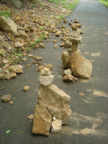 Glad that you neither got smashed by falling trees or falling rocks.