Has anyone ever explored the Hodge/Mackey/Lawn connection from the base of Bates to South Oakland as a bike connection?
Looks doable on google maps, but there's a section connecting Lawn and Mackey that could not be streetmapped.
Just curious....
swalfoort
2013-12-27 16:59:27
Swalfoort wrote:Has anyone ever explored the Hodge/Mackey/Lawn connection from the base of Bates to South Oakland as a bike connection?
Looks doable on google maps, but there’s a section connecting Lawn and Mackey that could not be streetmapped.
Just curious….
I've heard of this.
http://rockalley.org/
but don't typically go into oakcliffe.
ka_jun
2013-12-27 17:53:05
At some point we discussed it.
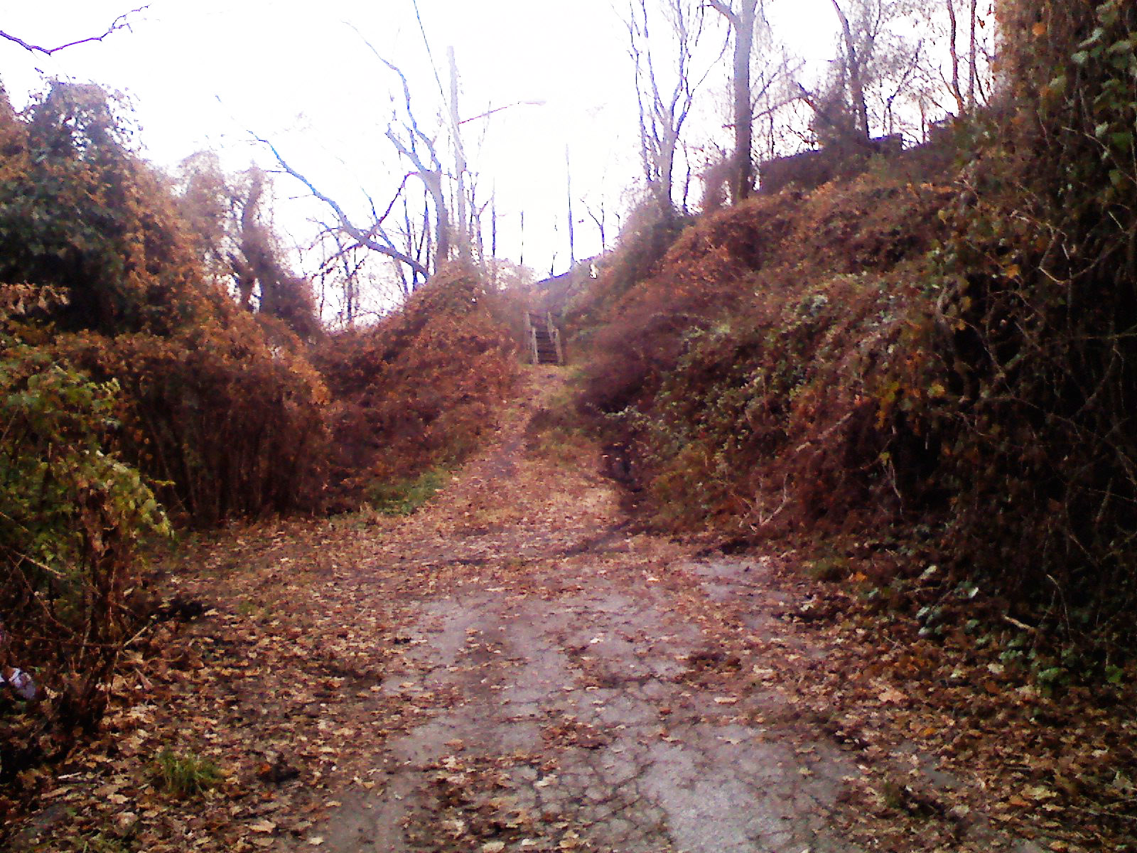
http://rockalley.org/routes/bike-routes/lawn-street/#hodge -- look at pictures -- there are two stairs.
mikhail
2013-12-27 18:22:48
Wow, I am not in Oakland very often, and don't follow local happenings there, but I am surprised that I never knew of rockalley before.
Thanks for that tidbit....I'll be reading up. And exploring.
swalfoort
2013-12-27 19:02:02
Swalfoort wrote:Wow, I am not in Oakland very often, and don’t follow local happenings there, but I am surprised that I never knew of rockalley before.
Thanks for that tidbit….I’ll be reading up. And exploring.
When we discussed... There is a service tunnel that starts on the 2nd and goes under Jail Trail and I-376 all the way up to the park. There were plans to use it for pedestrians so:
1. People have connectivity fron 2md to Oakland;
2. Residents could use parking garages at 2nd (very tight neighborhood).
But Dequesne Lights used tunnel to put heavy high voltage cable without permission and until after they remove/redo it all plans are on hold. :(
mikhail
2013-12-27 20:03:23
For reference purposes and to save people some searching, here are two old (2012) threads where we've discussed this before:
#1, April 2012
#2, November 2012
stuinmccandless
2013-12-27 20:12:58
Swalfoort wrote:Has anyone ever explored the Hodge/Mackey/Lawn connection from the base of Bates to South Oakland as a bike connection?
Since I am still off my bike I decided to walk around there during my lunch hour.
https://maps.google.com/maps?q=15219&hl=en&ll=40.433694,-79.958692&spn=0.001423,0.003154&sll=41.117935,-77.604698&sspn=5.767621,12.963867&t=h&hnear=Pittsburgh,+Pennsylvania+15219&z=19 -- pretty steep curve with really bad asphalt.
https://maps.google.com/maps?q=15219&hl=en&ll=40.432882,-79.95966&spn=0.001423,0.003154&sll=41.117935,-77.604698&sspn=5.767621,12.963867&t=h&hnear=Pittsburgh,+Pennsylvania+15219&z=19 -- as soon as you pass last house (20 yards after) there is almost no asphalt up to the stairs. Stairs 7+5+16) are wooden ones and very narrow -- about 3 feet wide. They end up at the end of street not as google shows. And then it's pretty steep climb pretty much all the way to Niagara str.
Oh, there is no house-building
https://maps.google.com/maps?q=15219&hl=en&ll=40.432932,-79.960129&spn=0.000356,0.000789&sll=41.117935,-77.604698&sspn=5.767621,12.963867&t=h&hnear=Pittsburgh,+Pennsylvania+15219&z=21 -- and that is why steps end up at the end of street.
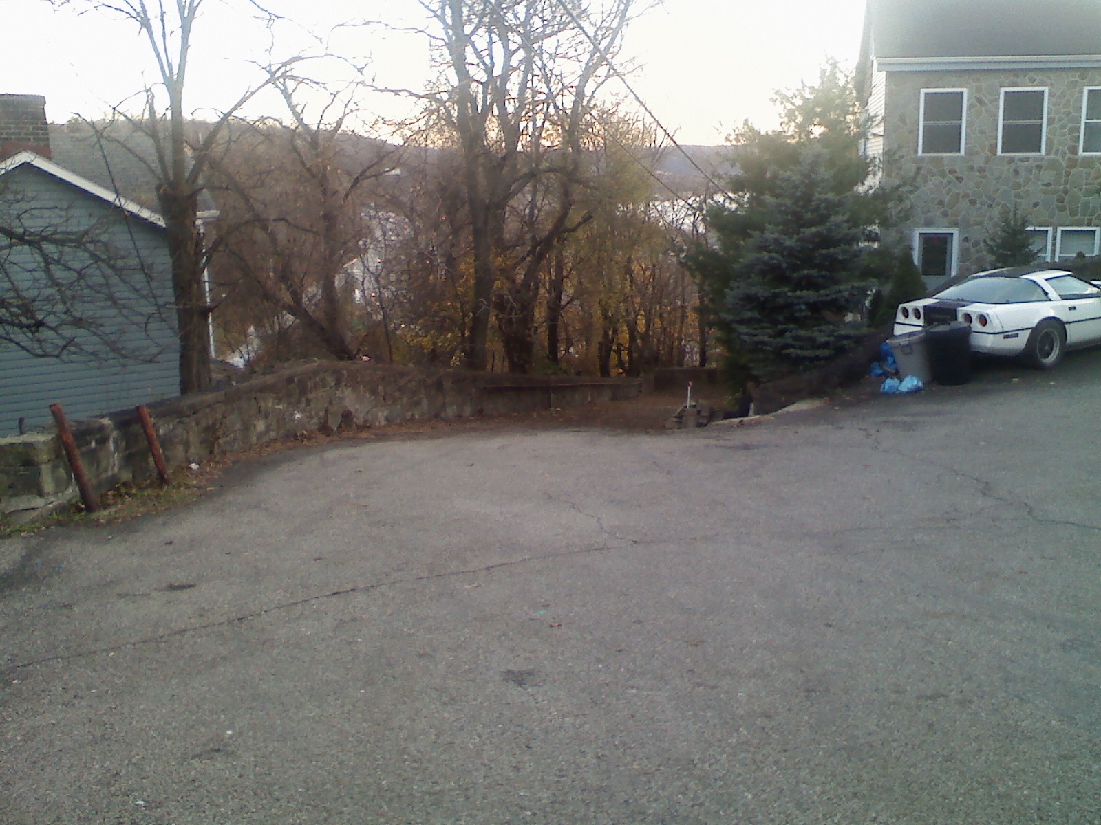
Corvette is still there but tires are flat (pictures are from
http://rockalley.org/routes/bike-routes/lawn-street/#hodge):
-- steps are at the very bottom of the street on left side.
mikhail
2014-01-13 15:44:52
I don't think my way is the most efficient, but I always just throw my bike on my shoulder and carry it down the steps a little past Iron City Bikes where Bouquet turns into Dawson to the start of that trail down there. Sometimes I get to say to hi the nice old lady who lives by there.
atown
2014-01-13 15:55:16
I use (on way down) Joncaire side walk all the way to Boundary or Joncaire side walk-Yarrow-Boundary. On way up -- Boundary-Yarrow-Joncaire sidewalk or Boundary-CMU garage-Forbes, or Boundary-Nevville. Last one is popular in both directions.
mikhail
2014-01-13 16:11:26
atown wrote:I don’t think my way is the most efficient, but I always just throw my bike on my shoulder and carry it down the steps a little past Iron City Bikes where Bouquet turns into Dawson to the start of that trail down there. Sometimes I get to say to hi the nice old lady who lives by there.
technically, South Oakland starts across the Blvd. Those steps are in Central Oakland. It's too bad the Boehm Street steps no longer exist.
ka_jun
2014-01-13 16:20:47
thanks for checking that out Mikhail. It doesn't look every promising as an alternate to Bates.
swalfoort
2014-01-13 16:57:44
There are stairs on the other side of Bates going up to Romeo St and Frazier St. They are concrete and might be wide enough for a bike run.
mick
2014-01-13 17:36:13
I started doodling in Google Maps and created a map of Pittsburgh bicycle connections I'd like to see in the coming years. I put some of the Rock Alley ideas there, plus some ideas for Schenley Park and the Steel Valley Trail. You should be able to view it here. If others want to edit it, I could add permissions for them, one by one.
https://mapsengine.google.com/map/edit?mid=ziK2QENwxXkY.kIOXx_KzVokE
paulheckbert
2014-01-20 01:13:26
We've had discussions about connecting the dead-end of Saline St by the Saline St Parklet, both north to Greenfield Road and south to somewhere near Greenfield Elementary School. I have no specific knowledge of the area, let alone its topography, so I am not the one to add the needed lines. But, short version:
* connect Anthony Street and Lydia or Neeb Streets, missing steps, steps that used to be there but were demolished
* switchback from the Parklet up to the corner near the bridge about to be torn down.
* extending Saline St as a trail beyond the dead-end by the Parklet, under the soon-to-be-demolished bridge, up to Pocusset St.
I think the goal is to have a reasonably intuitive direct path from Squirrel Hill to the Jail Trail without having to deal with any serious amount of traffic.
stuinmccandless
2014-01-20 10:08:11
A lot of interesting ideas there.
Have to cast votes for my favorite two for the sheer number of masters they serve: circumventing the chute staying left of the tracks and crossing over the tracks by the lake. Suddenly, it's actually quite nice to get to the jail trail from schenley park and visa versa, the lake becomes more accessible to folks in Oakland.
Bonus points also for combining with redone steps with rail behind that building with the fountain on schenley plaza. Then with the exception of ~100 feet on the joincare street sidewalk, the whole climb to the that high value high visibility area becomes something I wouldn't feel like I'd have to apologize to a visitor for my city over.
In fact, maybe even some arrangement could be made with the folks doing the parking at that corner and the steps could come down just a touch east, on their lot? Then you just have a natural branch point depending on destination with no particular crappiness involved. Image that if you will.
Now, how much would I use this on the way down? With my family, every time. By myself, not much, too impatient. So, super mega bonus points for serving the transportation cyclists better, say, if you can connect the new bit of trail west of the tracks up to Saline Street and the Frazier Street Bridge itself. So folks can bypass the chute coming from Greenfield avenue and perhaps at least use Swineburne Street into south Oakland in the downhill direction.
byogman
2014-01-20 12:31:51
StuInMcCandless wrote:
* switchback from the [Saline St] Parklet up to the corner near the bridge about to be torn down.
* extending Saline St as a trail beyond the dead-end by the Parklet, under the soon-to-be-demolished bridge, up to Pocusset St.
What I called the Naylor Trail and the Pocusset Trail Extension at
https://mapsengine.google.com/map/edit?mid=ziK2QENwxXkY.kIOXx_KzVokE are meant to cover these needs. A few weeks ago I hiked on that hillside to explore the idea of a long staircase between the east end of Saline St at the parklet, and the intersection of Greenfield Rd with Pocusset St. These stairs would be about 500 feet long, rising 130 feet. I concluded that it's too much. Yes, a staircase could be built, and a bike tire channel installed, but how many cyclists would use it? A bikeable trail at a lower grade (Naylor Trail and Pocusset Trail Extension) would work far better, I think. And it would be less expensive to build, I imagine.
A bypass that goes under the bridge to reduce cycle traffic crossing Greenfield Rd is a good idea, however. It would be neat to get that built into the new bridge design.
paulheckbert
2014-01-20 13:07:37
I used to live on Niagara St, so I tried using that connection once when Bates was all torn up for gas lines. The wood staircase is REALLY slick when wet, especially with road shoes and cleats. Would not recommend.
Also, glad to see that Corvette is still there. :)
rice-rocket
2014-01-20 13:13:38
Slippy wood steps? Can fix that with some roofing shingles.
stuinmccandless
2014-01-20 14:28:02
Mick wrote:There are stairs on the other side of Bates going up to Romeo St and Frazier St. They are concrete and might be wide enough for a bike run.
The stairs here are not that wide. Here's a pic for reference. It would be a tight fit for rails, but it might be doable.

benzo
2014-01-21 10:16:53
The Oakland Green Team out of Oakland Planning and Development would be a great place to start, if the deal is to get a community plan together to re-configure existing steps for a bike rail. See for example all the work being done around the Louisa Street Steps. Strike while the iron is hot! Contact David Zwier at OPDC.
aboykowycz
2014-01-21 10:33:42
ka_jun
2015-06-03 20:32:21