Hate scary connections and blind turns? Speak now or forever hold your peace.
Second Avenue, between 10th Street in Uptown to the intersection with SR 837/885 in Hays, is undergoing a Multimodal Corridor Study. This study’s intent is to look at this area and come up with a shared vision plan between the neighborhood and project leaders that focuses on multimodal access, mobility and livability through analyzing current and future transportation and land use conditions.
The top 4 goals of the project are to: (1) decrease single-occupancy vehicle trips, (2) provide mobility services and facilities, (3) encourage biking with a complete trail network and (4) increase the use of transit and other modes of transit progressions in the corridor.
The project is in collaboration between the Southwestern Pennsylvania Commission, PennDOT, the City of Pittsburgh, Allegheny County, and the Port Authority of Allegheny County.
Project Scope
This project will have an impact on people coming from the South Hills and those that live and commute through the neighborhoods in and adjacent to Second Ave. These neighborhoods being, Hays, Hazelwood, Oakland, and Uptown which are and make connections to some of the most job dense and concentrated bike/pedestrian areas of the City. However, there are many broken connections for biking and walking along Second Ave that are in need of examination.
Here are some of the bike/ped issues that we’ve identified:
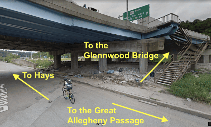
- A clear, safe connection from the Glennwod Bridge to the Great Allegheny Passage trail need signage and on-road markings
- Access to the Hays Woods area needs improved and made more accessible
- The Duck Hollow Trail is close, but there is no safe or legal connection
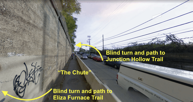
- “The Chute” (the Eliza Furnace trail along Second Ave from Swinburne St. to Saline St.) is dangerous to bike and walk through and has blind curves
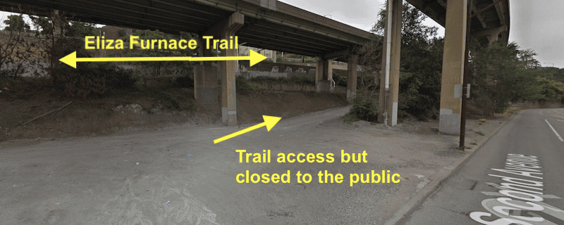
- Safe connections to the Eliza Furnace Trail need to be made at:
- Bates St.
- Brady St.
- 10th St. Bridge
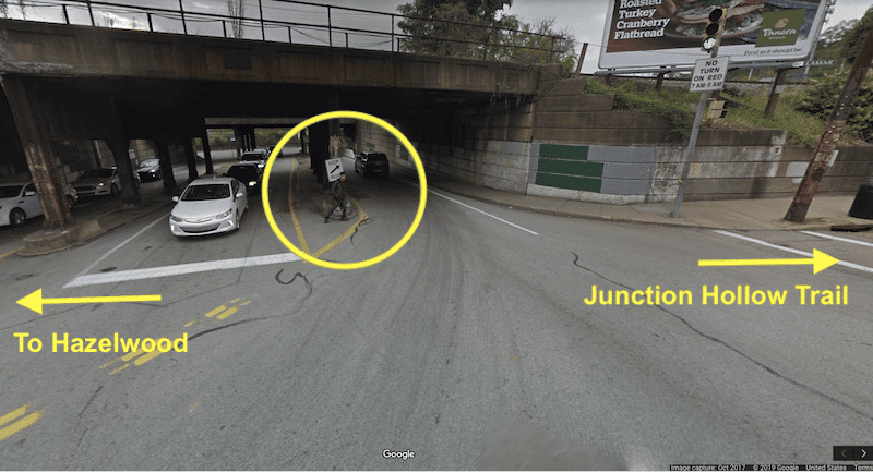
- Hazelwood Green Bike Path
The Second Ave project spans about 5.2 miles of City streets. The project team is planning to publish their study’s results in June.
Here are some visuals of the areas of concern that were captured using Google Maps. Google Maps also randomly happened to include cyclists and pedestrians using these areas:

HOW YOU CAN HELP: SHARE YOUR FEEDBACK

Add feedback to this online map
The steering committee and project staff are looking for your feedback via comment collection through their online map and a public meeting.
This Strava heatmap shows where the most popular biking and walking routes are in the area. As you can see, the GAP and Second Ave. are popular routes.
Hurry! You only have until March 13 to provide feedback! Click here to send feedback.
Speak Up at the Public Meeting
Public Meeting Details:Date: Tuesday, February 19, 2019Time: 5:00pm to 7:00pm Location: International Union of Operating Engineers, 300 Saline Street, Pittsburgh, PA 15207
If you cannot attend this meeting, you can send questions or comments to: spcsecondavenue@wrallp.com

Sign up for Bike Pittsburgh’s newsletter, The Messenger, to get the latest news on events, bike and pedestrian infrastructure, and fun, delivered straight to your inbox. Twice monthly emails, no spam.