
Try some of these amazing parks and trails in and around Pittsburgh
During troubling times, bicycling remains a safe and excellent way to get exercise while keeping a safe distance from others.
As with any outdoor activity, be sure to practice responsible social distancing, and stay at least 6+ feet away from other folks during your trip.
Cycling is a stress reliever and can even give you a boost to your immunity, especially important in the midst of a health crisis. Cycling can also provide a sense of routine and calm for many people during stressful times.
If you are tired of riding around your neighborhood street for the nth time, we have a few nearby route options for you to explore.

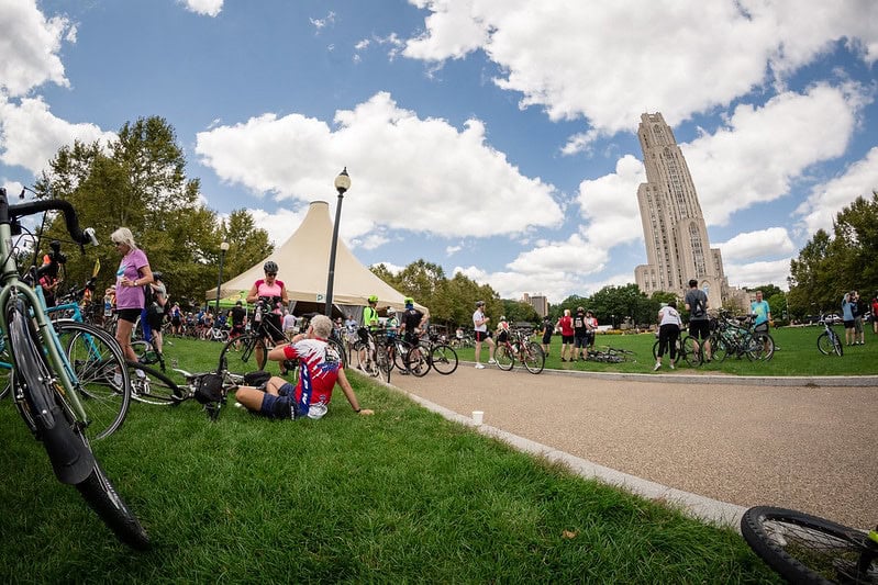
South Side Riverfront Park Trail
View the Map | 15.4 Miles Long | Paved
Connecting over 15 miles of trails, you can bike or walk all the way from the riverfront to station square, and even into the Great Allegheny Passage! This is an excellent option for the whole family because the entire path is paved, making this an easy ride for newcomers of all ages. Get great views of the river, hopefully, abandoned parking lots for practicing wheelies, and lots of different stretches of the South Side through Station Square to check out.
Fun Fact: This park is where our annual PedalPGH ride starts.

Highland Park Reservoir
View the Map | 1.7 Miles Long | Paved
The outer loop of Highland Park is 1.7 miles with a buffered bike lane and minimal cars. The reservoir is accessible through a Victorian-style gathering place with gardens, a fountain, benches and reflecting pool. Highland Park also features a popular bike track, sand volleyball courts, and the Pittsburgh Zoo and PPG Aquarium.
Schenley Park
View the Map | 2.9 Miles Long | Paved
Schenley Park is one of the largest city parks, with a looping, nearly 3 mile paved road to ride on. The park is made up of 300 acres. It is home to the main branch of the Carnegie Library, Phipps conservatory and some of Pittsburgh’s most prestigious colleges. The park itself is beautiful as a whole and there’s plenty to keep the family busy after your ride,including disc golf, playgrounds, and open space. Among all the sights and trails the park is also equipped with a protected two-way bike lane that connects to playgrounds, trailheads and low traffic rideable streets.

Coal & Coke Trail
View the Map | 7.3 Miles Long | Paved/gravel
This trail features main streets lined with antique brick buildings, historical monuments and a long history of farming and manufacturing. Between Mt Pleasant and Scottsdale is a scenic sample of Westmoreland County countryside, and traveling the Coal & Coke Trail is the perfect way to see it. True to its name, the Coal & Coke Trail passes through former industrial sites where the black rock was once mined and processed, although most of what you’ll see today are trees, houses, and greensward. Along with fields and woodland, you’ll pass plenty of backyards, motorways and athletic fields. The trail is just long enough for a leisurely afternoon ride, and it runs parallel with a lovely creek and the still-functional railroad. Local volunteers are working to refine the route, improving signage and fluidly linking different trail segments.
Eliza Furnace Trail
View the Map | 5.7 Miles Long | Paved
From Hazelwood to downtown Pittsburgh, and a part of the citywide Three Rivers Heritage Trail system, the Eliza Furnace Trail is named after the old factories that once smelted steel along the Monongahela River. The trail offers unique views of the river, the Birmingham Bridge and the South Side. Parking lots at both ends make it easy to load and unload bicycles, and during times of gridlock through Uptown and the Hill District, the trail is a great way to beat that traffic. The Eliza Furnace is one of Pittsburgh’s oldest trails as well as one of its most popular.

Westmoreland Heritage Trail
View the Map |8.5 miles from Saltsburg to Delmont
9.3 miles from Export to Trafford | Paved
One of the new routes is the Westmoreland Heritage Trail. Not just because it traverses some beautiful countryside but also because it is an ambitious work in progress. Pittsburghers who never had much reason to cruise through Westmoreland County will have the chance to explore these communities in a whole new way. See how the newest addition to Pennsylvania’s trail system evolves in forthcoming years. Some sections of the trail will intersect with roads, so be sure to cross those intersections carefully.

West Penn Trail
View the Map | 14.7 Miles Long | Paved/mix/dirt
As does the Westmoreland Heritage Trail, the West Penn Trail has a trailhead in Saltsburg, so in theory, you could travel one and then try the other on the same day (if the kiddos are up for it). The route through Indiana County roughly follows the Conemaugh River, except that it’s much straighter than the winding waterway as it cuts a near-direct path to Blairsville. There isn’t much human settlement between the two towns, so the West Penn Trail is the perfect place to commune with the natural environment. The Conemaugh is a powerful river that used to serve as a canal for riverboats, and the views it provides are varied and beautiful.

Steel Valley Trail
View the Map | 8.5 Miles Long | Paved/gravel
Steel Valley. It has the same Pittsburgh steel roots and shadows the railroad on the Monongahela River. Plus, it’s the start of the Great Allegheny Passage. And while this trail passes right by Sandcastle and Kennywood, the real fun is being had on your bicycle. This well-maintained and scenic trail is an adventure waiting to happen.