Here’s how to make your voice heard in the East Liberty Pedestrian & Traffic Safety Plan
Pittsburgh’s East Liberty neighborhood is one of the fastest changing neighborhoods in the city. Some of these changes having been welcomed by the community, while others have presented challenges for local residents. As residential and commercial development continues to reshape the area, it is important that the people who currently live in, work in, and visit East Liberty can get around safely, especially if they don’t have access to a car and use transit.
In addition to crash data, the City of Pittsburgh’s Department of Mobility & Infrastructure (DOMI) is seeking public input from the community to identify problematic areas for pedestrians and transit users. Processes like this are important so that the city has an understanding of which sections of the road to prioritize, and to secure the funding to make the improvements. Meanwhile, this process is also important to the people so that we can have a clearer understanding of what changes to look forward to once the plans are set into action.
High Crash areas to be prioritized
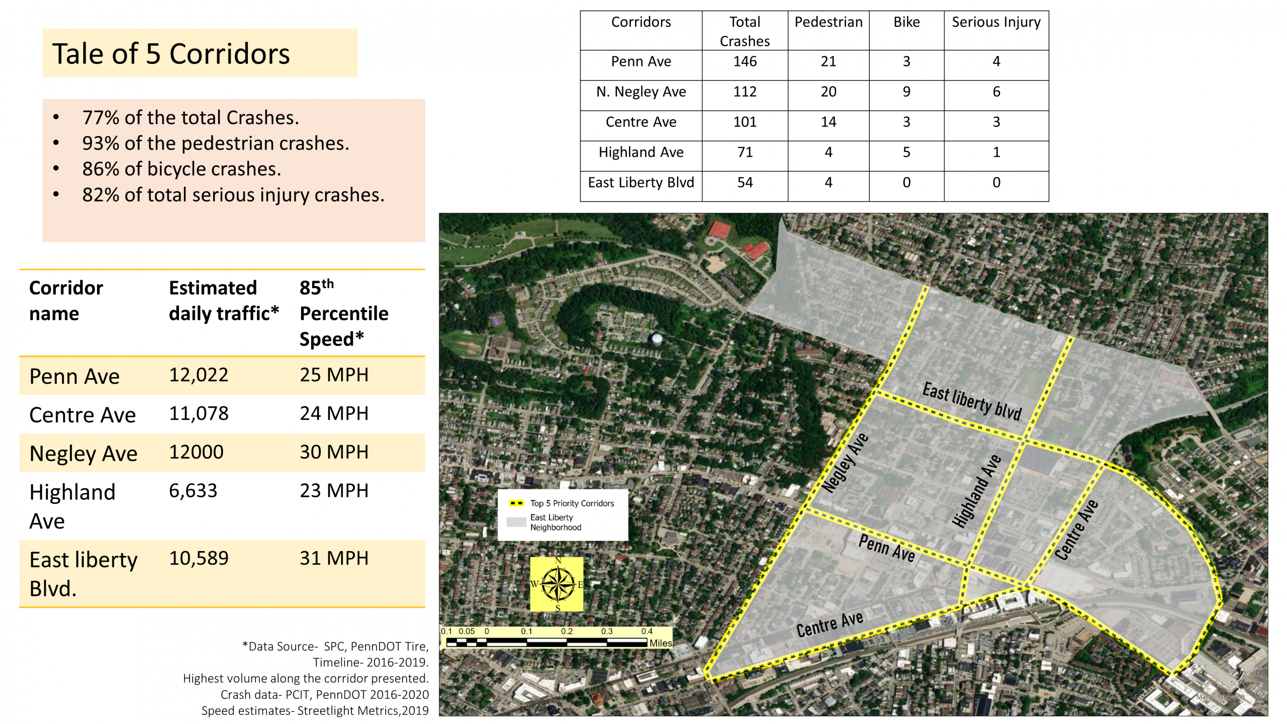
DOMI has identified these objectives of the plan: Pedestrian Safety, Traffic Safety, and Bus Stop Accessibility & Amenity Improvement. In addition, DOMI lists the following areas, which comprise 77% of all crashes in the area and 93% of pedestrian crashes, are the “Priority Corridors” that will be analyzed:
•Penn Ave (From East liberty Blvd to N Negley Ave)
•N Negley Ave (From Centre Ave to Hays St.)
•Centre Ave (From N Negley Ave to East Liberty Blvd)
•Highland Ave (From Centre Ave to St. Marie)
•East Liberty Blvd (From N. Negley Ave to Penn Ave)

Join the Conversation
Now that you are ready to give your opinion, visit the feedback page on the East Liberty Priority Corridors Pedestrian & Traffic Safety Plan webpage. We encourage you to voice your concerns about specific traffic issues, or share your experiences walking or riding a bike in the area and provide suggestions for improvement.
In addition to adding to the comment section, you can also mark your safety concerns on the interactive map. It’s really quick and easy to flag a dangerous spot or somewhere that could just generally use some improvements.