Help advance some great projects for neighborhoods that lack bike infrastructure
Over the past several years, the City of Pittsburgh has been creating a number of neighborhood-level mobility plans to assist areas with a historic lack of attention, or who have unique transportation needs. These plans aim to not only make the whole transportation system safer and more efficient in the given community, but to identify specific projects that will make an impact.
Such plans as the East Liberty Priority Corridors Pedestrian & Traffic Safety Plan, the Homewood Mobility Plan, and The Oakland Plan have led to real world changes on our streets based on resident feedback, need, and priority. Including these projects in plans significantly improves the chances that the project will advance, receive funding, and get constructed as they’ve demonstrated a level of community support.
The City launched the latest neighborhood-specific transportation plan with the draft West Pittsburgh Mobility Plan. Focusing on the neighborhoods of West End, Esplen, Elliott & Sheraden, in addition to improving mobility, the plan also aims “to reduce health disparities and achieve health equity by promoting healthy living and active lifestyle.” Unique to this plan is that the area was identified in the Racial & Ethnic Approaches to Community Health (REACH) by Allegheny County Health Department (ACHD) & Centers for Disease Control (CDC), who are both part of the process.
The West Pittsburgh Mobility plan will address three key areas: Pedestrian & Traffic Safety, Connectivity & Accessibility Improvement Among Neighborhoods, Community Placemaking & Wayfinding.
What’s in the plan
These plans don’t appear out of nowhere. Planners need to gather feedback from the community in various ways over many months, while also including previous efforts into a single document to rule them all. Taking into consideration previous work such as the Sheraden Park Master Plan and the Move Forward PGH effort to advance the City’s Bike(+) Plan, the team has developed a suite of priority projects to focus on over the coming years.
There are a lot of exciting recommendations in the plan, which you can see in full here.
Two highlights stand out to us as especially important.
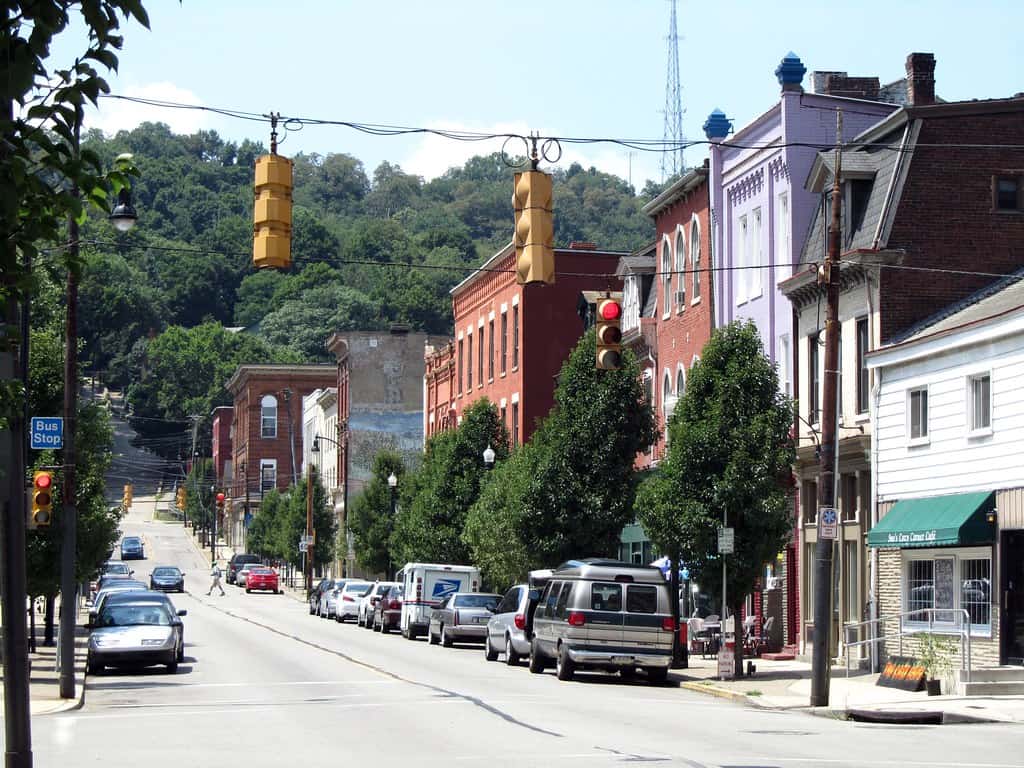
Chartiers Ave Community Connector
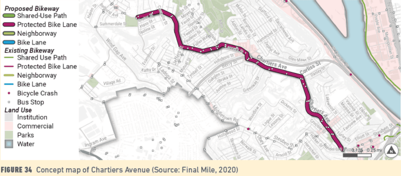
Chartiers Ave runs through all of the neighborhoods in the West Pittsburgh Mobility Plan area, and it connects neighboring communities as well. As is said in the plan, “Chartiers Avenue has the potential to serve as the core of multimodal connectivity for West Pittsburgh.”
Here’s what the plan recommends for Chartiers Ave:
- Install connected, high-quality dedicated bicycle facilities. A concept map in the plan indicates a proposal for “protected” bike lanes on Chartiers Ave, though the specific format remains to be determined.
- Provide continuous, quality sidewalks on both sides for the entire corridor.
- Update crossings with high visibility pavement markings, pedestrian islands / curb extensions, and curb ramps.
- Work with PRT to add bus shelters for transit riders.
- Install directional wayfinding leading to community destinations alongside mobility projects.
The West Pittsburgh Bike/Ped Committee has been advocating for bike lanes and sidewalk improvements on Chartiers Ave for years, and it is great to see a clear recommendation for exactly that in this plan.
Sheraden Station Plaza
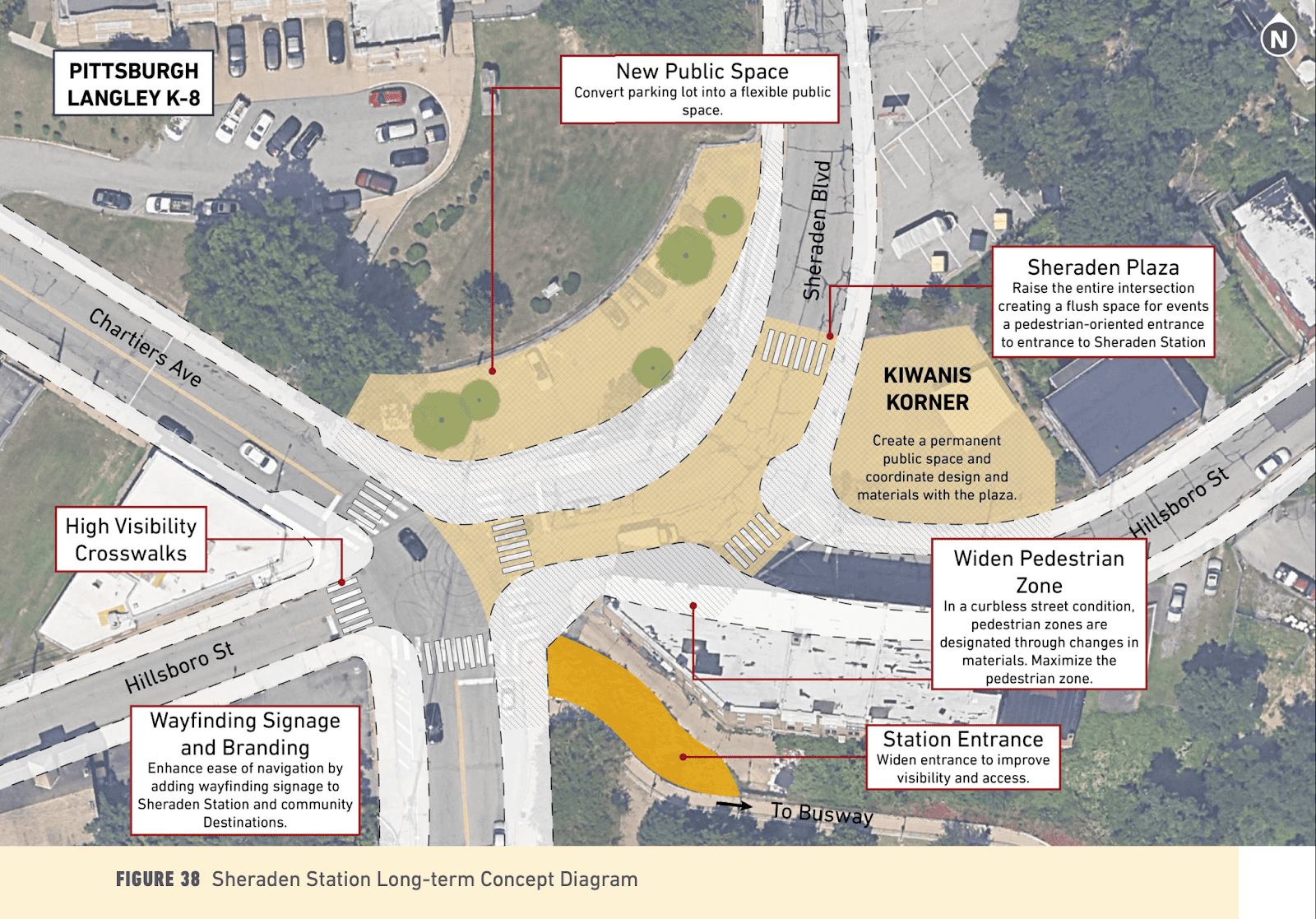
The intersection of four different streets plus the West Busway near a school produces one of the more confusing and unsafe traffic patterns in the City. However, as the plan says, this area has the potential to be the “front porch” for Sheraden with vibrant public spaces and amenities connecting a public transit hub with local businesses, the school, and nearby residents. The plan recommends developing this “front porch” in two phases:
- Phase 1 – Use “quick build” materials like flex posts and paint to test new layouts for the intersection, with a focus on calming traffic, increasing visibility, and improving safety for people who walk and bike.
- Phase 2 – Once a design is settled on after some experimentation, “harden” the intersection with concrete, asphalt, and other more permanent materials. One idea is to raise a large portion of the intersection to create a pedestrian-friendly plaza.
BikePGH knows from talking with residents and working with youth at nearby Langley School how important it is for this area to be made safer for walkers and bikers.
What you can do
Public feedback and support will be critical to seeing projects such as these move forward.
Attend the March 18 Public Meeting at 6pm: Join the City online, or in-person at the West End Healthy Active Living Center (80 Wabash St, Pittsburgh, PA 15220) for a community meeting for the West End Mobility Plan with the Department of Mobility and Infrastructure and Council District 2.
See the Engage Page for registration details.
Leave Comment on the Engage Page (by April 3): You can leave specific comments on the project Engage Page about what’s good, what’s missing, and what needs to change. Be sure to do so by April 3.